
Price: $68.95
(as of Aug 04, 2025 17:23:36 UTC – Details)

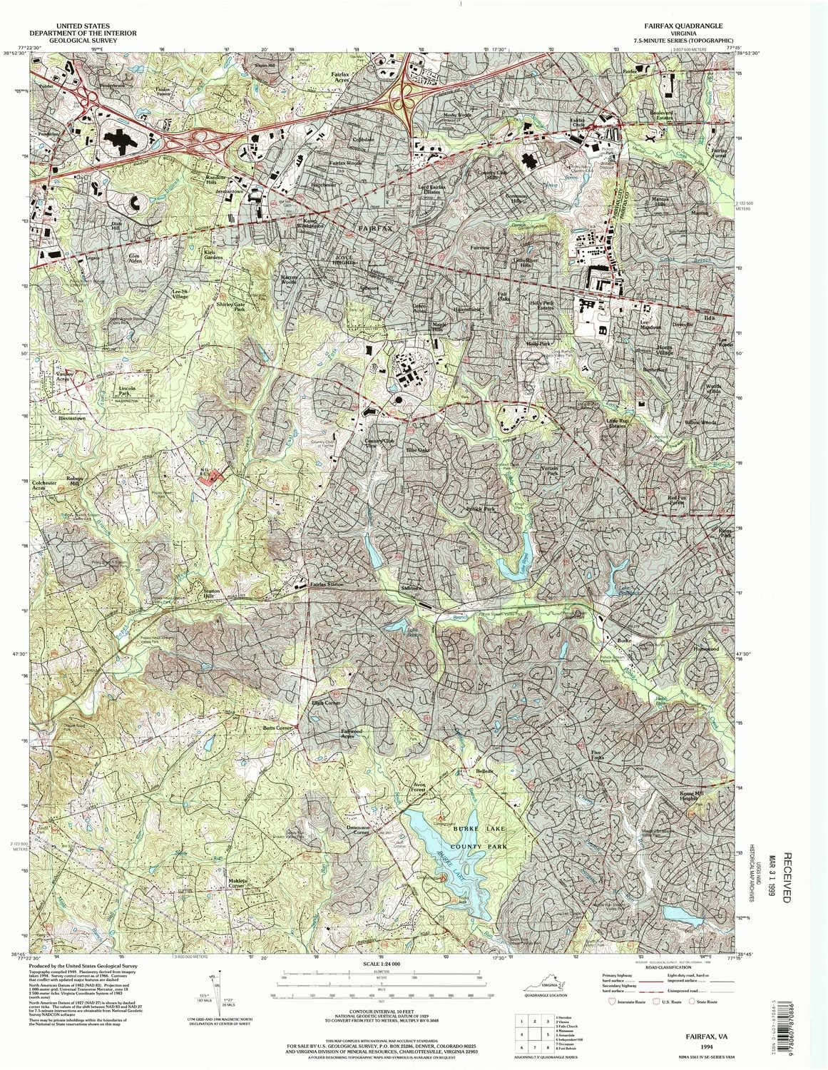
USGS topographic map of Fairfax, Virginia, dated 1994, updated 1998.
Includes geographic coordinates (latitude and longitude), lines of elevation, bodies of water, roads, and more. This topo quad is suitable for recreational, outdoor uses, office applications, or wall map framing.
Printed on-demand by YellowMaps on the print material of your choice.
Shipping rolled from Minneapolis, MN, United States.
Product Number: USGS-5297980
Map Size: 27 inches high x 22.1 inches wide
Map Scale: 1:24000
Map Type: POD USGS Topographic Map
Map Series: HTMC
Map Version: Historical
Cell ID: 70039
Scan ID: 184931
Imprint Year: 1998
Woodland Tint: Yes
Aerial Photo Year: 1994
Datum: NAD83
Map Projection: Universal Transverse Mercator
Map published by United States Geological Survey
Map Language: English
Scanner Resolution: 600 dpi
Map Cell Name: Fairfax
Grid size: 7.5 X 7.5 Minute
Date on map: 1994
Geographical region: Virginia, United States
Northern map edge Latitude: 38.875°
Southern map edge Latitude: 38.75°
Western map edge Longitude: -77.375°
Eastern map edge Longitude: -77.25°
Surrounding map sheets (copy & paste the Product No. in the search bar):
North: USGS-5301716,USGS-5301710,USGS-5301714,USGS-5301718,USGS-5301712
East: USGS-5296237,USGS-5296235,USGS-5296239,USGS-5302194,USGS-5689368
South: USGS-5300158,USGS-5300140,USGS-5300152,USGS-5300144,USGS-5300148
West: USGS-5299464,USGS-5299466,USGS-5299470,USGS-5299476,USGS-5299468
Printed on Tyvek® (synthetic)
USGS topographic map of Fairfax, VA, at 1:24000 scale. Lighter material. Waterproof. Tear-resistant. Foldable. Very durable. Perfect for backpacking and the outdoors.
Cities, towns, villages: Ardmore,Jermantown,Sideburn,Fairfax Forest,Ilda,Willow Woods,Penderlan,Fairfax Farms,Lord Fairfax Estates,Green Acres,Avon Forest,Keene Mill Heights,Warren Woods,Belleair,Lincoln Park,Fairwood Acres,Little River Hills,Fairfax Woods,Station Hills,Mantua,Colchester Acres,Glen Alden,Maple Hills,Holly Park,Lee Forest,Doveville,Fairchester,Blevinstown,Mantua Hills,Fairfax Acres,Lee-Hi Village,Rutherford,Mosby Woods,Fairfax,Country Club View,Fairview,Lee Meadows
Mountains: High elevation topographical features like high summits and peaks.
Valleys: Low elevation topographic features such as flatlands, river valleys, and canyons.