
Price: $68.95
(as of Aug 25, 2025 18:41:43 UTC – Details)

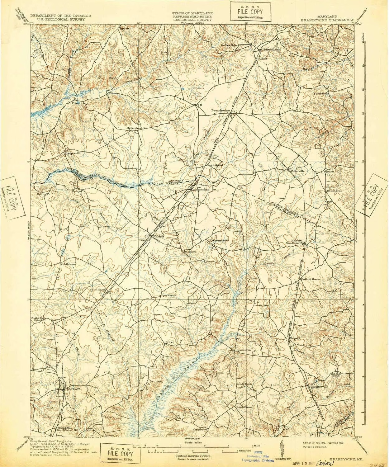
USGS topographic map of Brandywine, Maryland, dated 1913, updated 1932.
Includes geographic coordinates (latitude and longitude), lines of elevation, bodies of water, roads, and more. This topo quad is suitable for recreational, outdoor uses, office applications, or wall map framing.
Printed on-demand by YellowMaps on the print material of your choice.
Shipping rolled from Minneapolis, MN, United States.
Product Number: USGS-5367998
Map Size: 19.8 inches high x 16.5 inches wide
Map Scale: 1:62500
Map Type: POD USGS Topographic Map
Map Series: HTMC
Map Version: Historical
Cell ID: 51736
Scan ID: 257325
Imprint Year: 1932
Survey Year: 1911
Datum: Unstated
Map Projection: Polyconic
Map published by United States Geological Survey
Map Language: English
Scanner Resolution: 600 dpi
Map Cell Name: Brandywine
Grid size: 15 X 15 Minute
Date on map: 1913
Geographical region: Maryland, United States
Northern map edge Latitude: 38.75°
Southern map edge Latitude: 38.5°
Western map edge Longitude: -77°
Eastern map edge Longitude: -76.75°
Surrounding map sheets (copy & paste the Product No. in the search bar):
North: USGS-5368578,USGS-5389822,USGS-5930629,USGS-5367596,USGS-5930207
East: USGS-5368480,USGS-5368486,USGS-5365770,USGS-5365772,USGS-5365768
South: USGS-5368672,USGS-5368674,USGS-5368594,USGS-5368606,USGS-5367032
West: USGS-5930427,USGS-5389854,USGS-5367042,USGS-5304024,USGS-5367046
Printed on Tyvek® (synthetic)
USGS topographic map of Brandywine, MD, at 1:62500 scale. Lighter material. Waterproof. Tear-resistant. Foldable. Very durable. Perfect for backpacking and the outdoors.
Cities, towns, villages: Brandywine Forest,Mariellen Park,La Plata,Rosewick,Brookwood Acres,Westlake Village,Warburton Manor,Bel Air Acres,Malcolm,Mandleys,Parker Meadows,Belleair Estates,Cheltenham Acres,Kings Manor South,Sharperville,Roosevelt Heights,West End Farms,Oakland Estates,Haldane,Park Estates,Holly Tree Park,Jennie Run Estates,Land Tree,Northwood,North Keys Estates,Talbert (historical),Clinton Woods,Brooke Jane Manor,Friendly Farms,Wakefield,White Hall Terrace,Knolland,Glen Oak
Mountains: High elevation topographical features like high summits and peaks.
Valleys: Low elevation topographic features such as flatlands, river valleys, and canyons.